GPS City

Using GPS points to map out a city we get a new dimension to our maps. Using the increasingly ubiquitous GPS data available it occurs to me we have a new way to cartographically visualize infrastructure. With the combination of millions of GPS points we can build up an great view of the city.

null
We can tell where the busy roads and junctions are without any road hierarchy attributes or traffic monitoring. Cities pays millions to monitor traffic and here I can produce a more informative visualization on the fly. It’s not upto the statistical rigors of a road planner but it is visually more informative at a glance.

truck

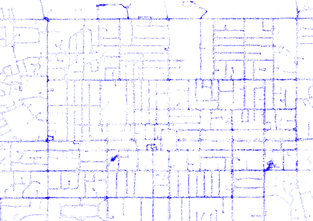
Here is the cities road network generated entirely from GPS points:

null


Posted

in

by

Tags:

Comments

5 responses to “GPS City”

  1. Rachel Avatar
    Rachel

    This is very cool. What are you capturing the GPS points from?

    Like

    1. Lucas Avatar
      Lucas

      I pulled the data from a fleet of city sanitation vehicles in this case. If you look carefully you can see where the vehicles spend most of their time

      Liked by 1 person

      1. Lucas Avatar
        Lucas

        There is a company in New Zealand called smartrak, they provide gps units on fleet vehicles. I used their data as the fleet of vehicles has a contract with them.

        Like

  2. Surveyors Auckland Avatar

    These are some great gps city that you have discussed here. I really loved it and thank you very much for sharing this with us. You have a great visualization and you have really presented this content in a really good manner.

    Like

    1. Lucas Avatar
      Lucas

      Thanks, I’m glad you enjoyed it.

      Like

Leave a reply to Lucas Cancel reply